 Facebook
 X
XShipXplorer Features: Port View
ShipXplorer Solutions: Port View
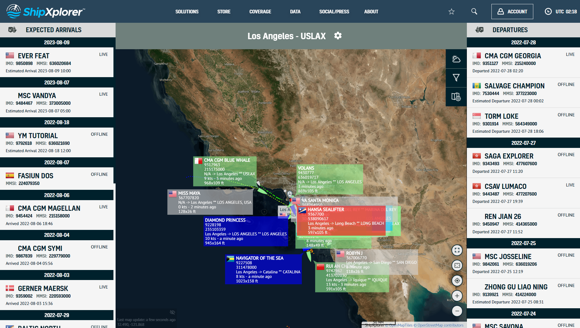
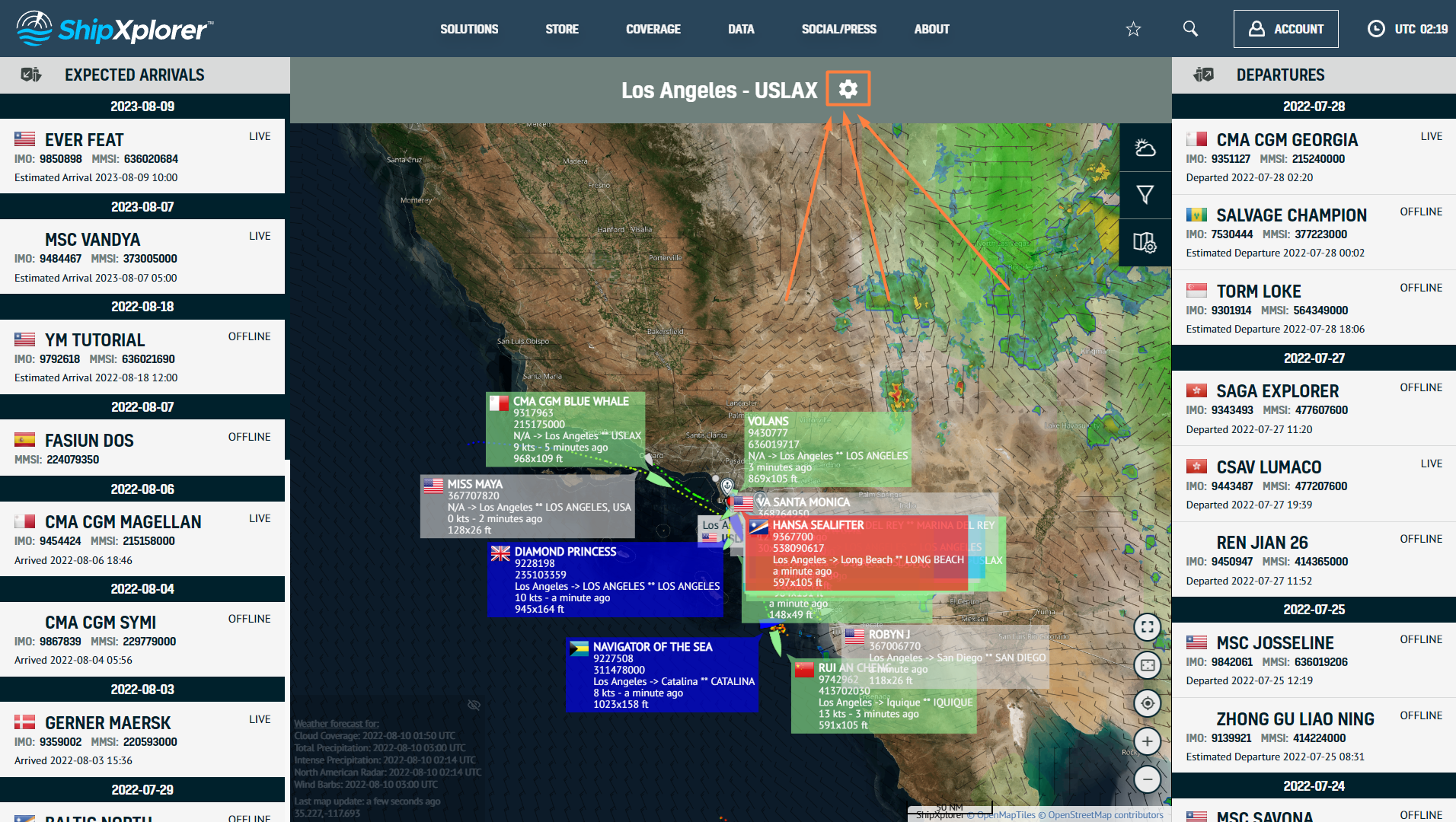
The ShipXplorer Port View tool was designed chiefly for port operators, officers and staff involved in port operations. Port View displays incoming and outgoing vessel traffic of an individual and specific port. This blog explores the brand new feature in detail.
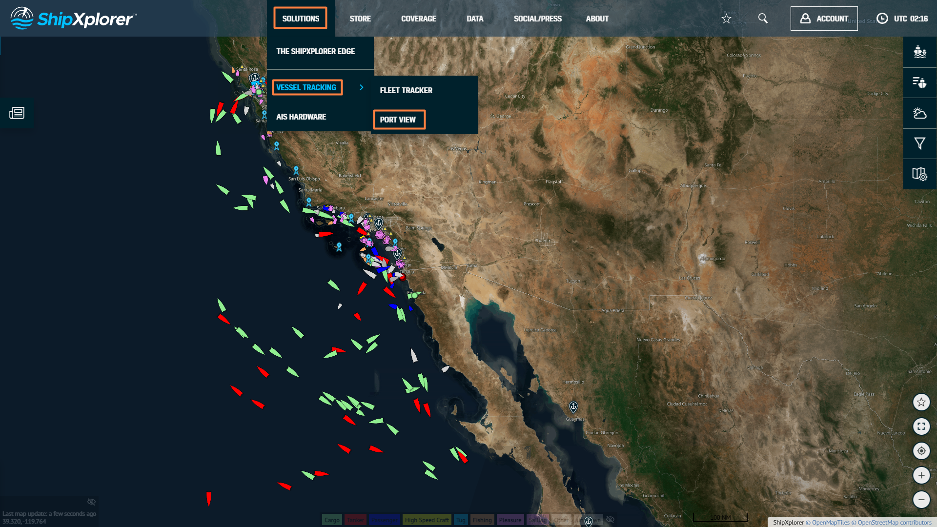
To access this feature, select the "Solution", "Ship Tracking", and "Port View" option. It is worth noting that this tool is only available for Business accounts.
Features:
- Wind barbs
- Cloud coverage
- North American Radar
- Total Precipitation
- Separate Arrival & Departure Cards.
- Monitor Inbound & Outbound Traffic.
- 11 distinct maps.
- Powerful filters for efficient fleet management.
- 24x7 Priority customer support.
Then type the port name. For example, USLAX (Country/Port Code) corresponds to the Port of Los Angeles in California, USA.
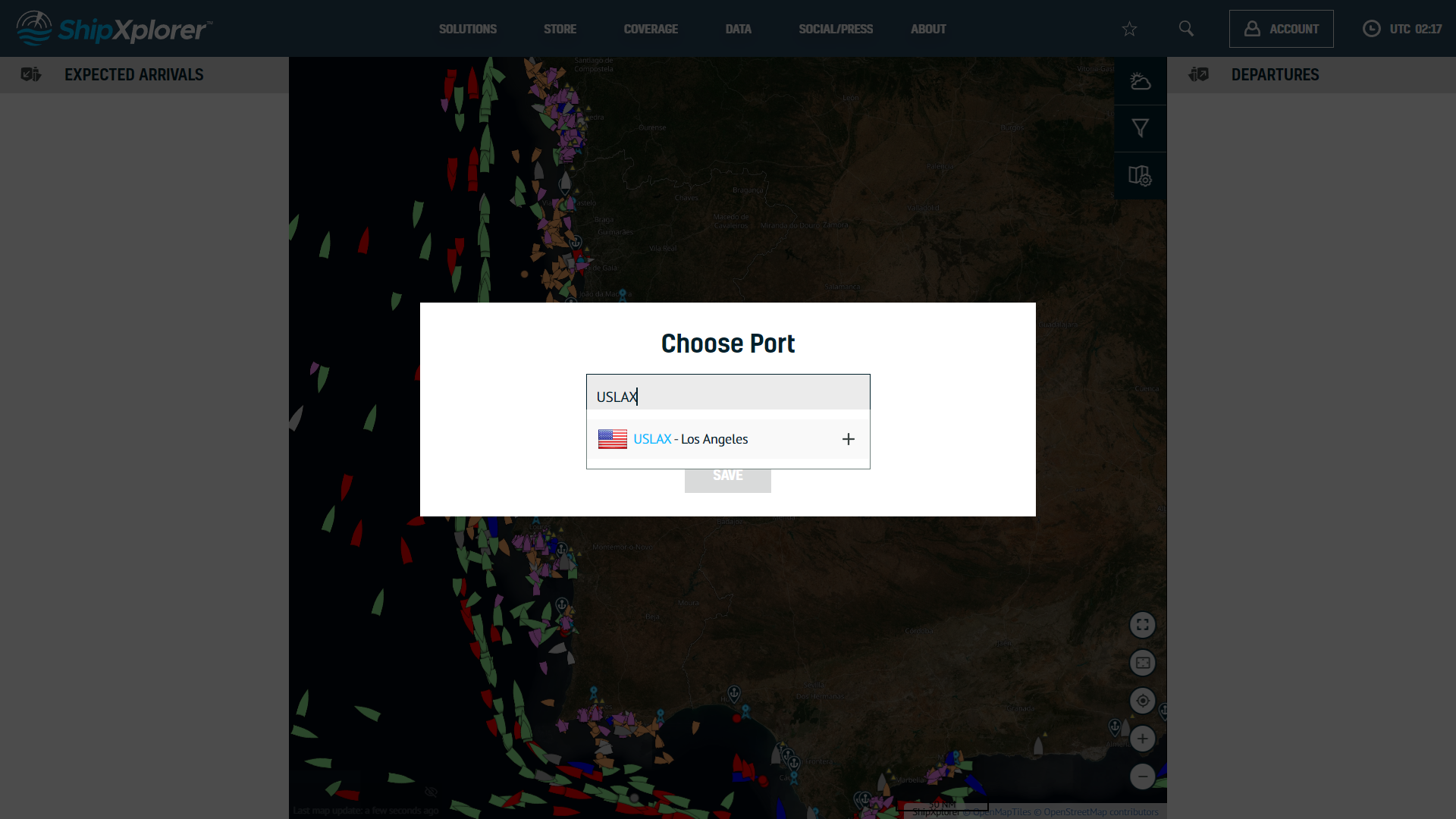
Port View provided by ShipXplorer
After entering the port's name, click on "save". For example, we've selected the port of Los Angeles (USLAX).
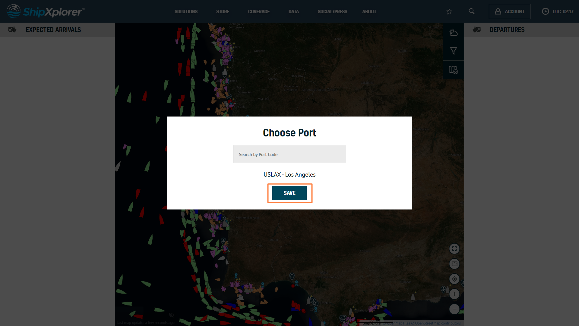
Port View provided by ShipXplorer
Port View can also serve as an information system to display arrival and departure information while passengers wait for their ships/cruises. As mentioned previously, Port View comes included with your Business account subscription and doesn't have a complicated setup process.
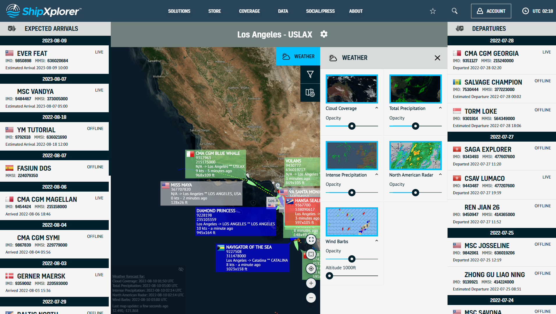
ShipXplorer weather layer includes:
- Cloud coverage
- Total precipitation
- Intense precipitation
- North America radar
- Wind barbs
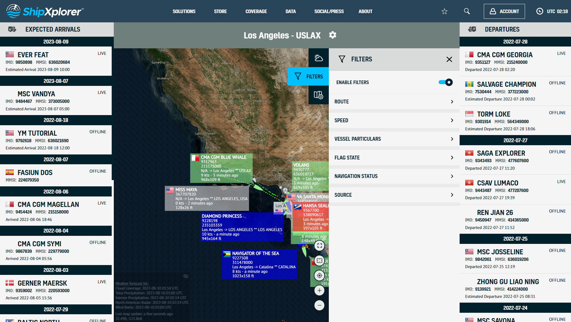
We also provide a variety of filter options such as route, speed, particular ships, flag state, shipping state, source, etc.
ShipXplorer currently offers 9 different map options that aims to provide our users with the freedom of customizing their map views. The map options available are:
- Marine 1
- Marine 2
- Marine 3
- Simple
- Monochrome
- Terrain
- Flat
- Dark
- Satellite
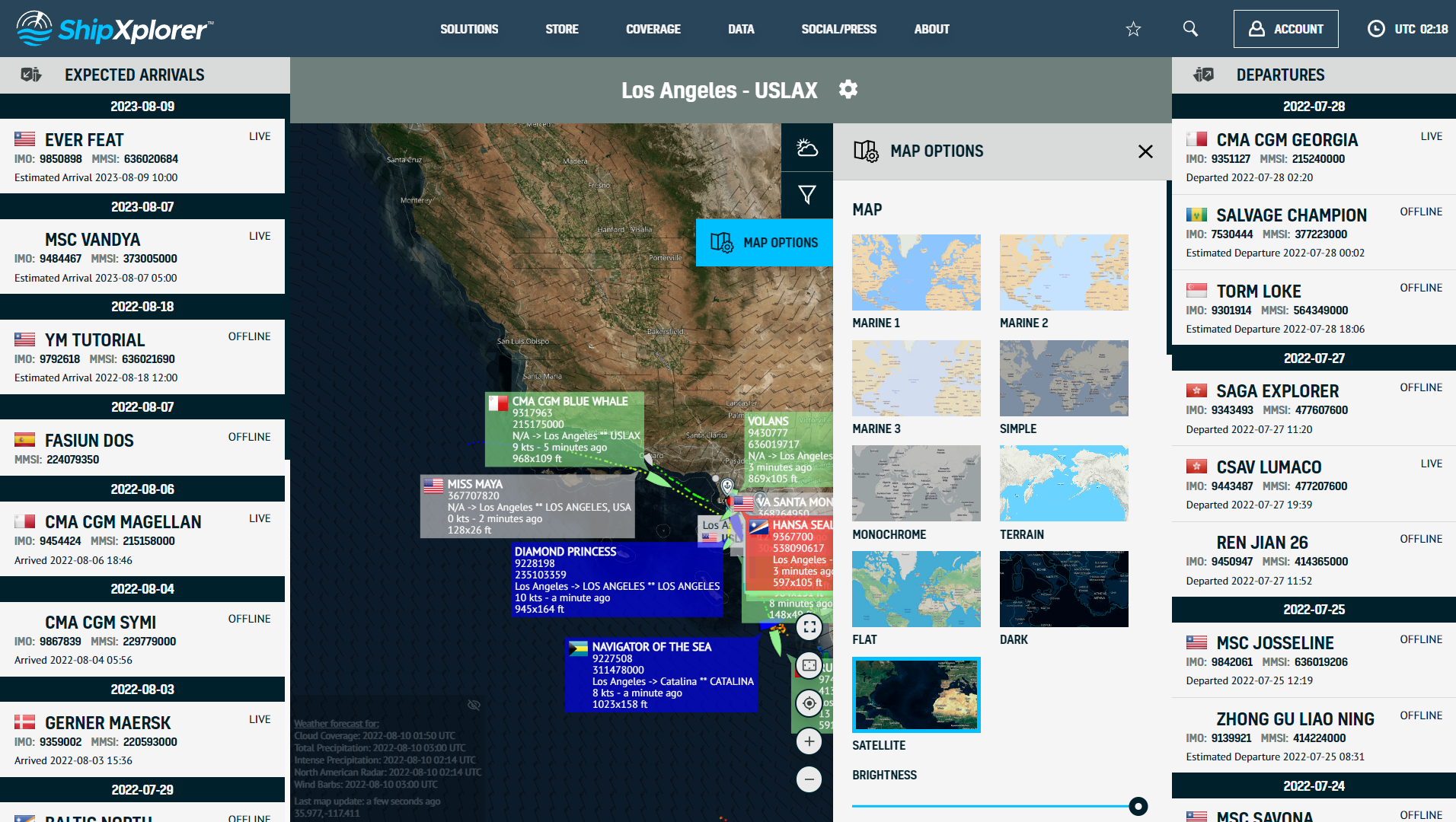
Port View - Map Options (Satellite, terrain, etc.)
Overlays give users additional tracking information by overlaying features on the map layout.
- Day/Night Layer – Enabling this layer adds a shadow on the map, displaying if it is day or night in different parts of the world.
- Seamarks - A sea mark, also seamark and navigation mark, is a form of aid to navigation and pilotage that identifies the approximate position of a maritime channel, hazard, or administrative area to allow boats, ships, and seaplanes to navigate safely.
- Maritime Zones - A conceptual division of the Earth's water surface areas using physiographic or geopolitical criteria.
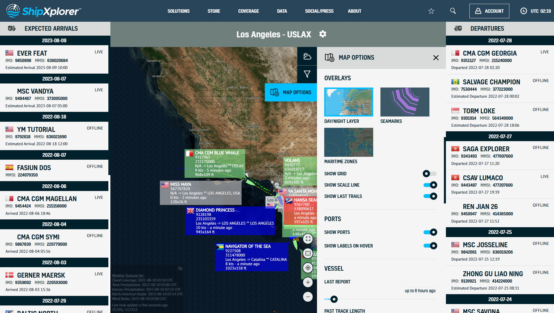
Port View - Overlays (Day/night layer, seamarks, maritime zones)
Select the tool icon at the top of the Port View to find a different port and click on it.
ShipXplorer Solutions: Port View
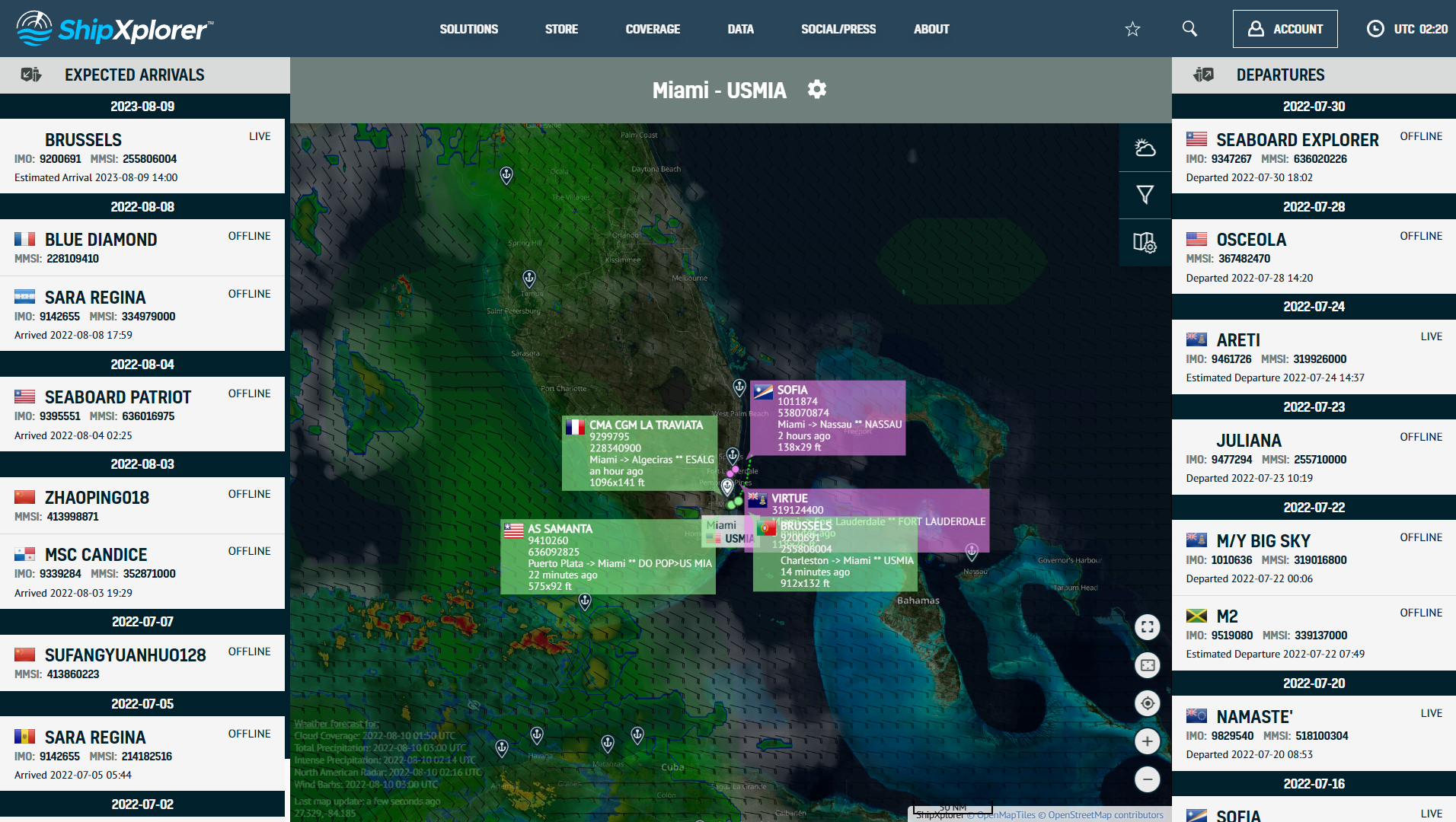
Type in the port name you want to track, for example, USMIA (Miami). Select the port and save it.
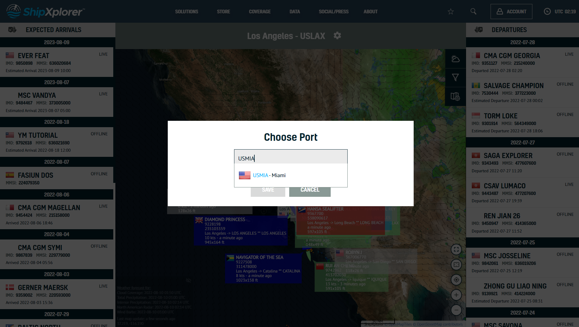
ShipXplorer Solutions: Port View
Now you can observe all ships in and out of Miami or the port you have entered.
For more information about what each subscription plan offers, visit: ShipXplorer.com/subscribe
READ NEXT...

- arctic
- north-pole
- le-commandant-charcot
- north-pole-expedition
- 50-years-of-victory
- russia
- ukraine
- russian-ukrainian-war
- war
- peace
- ship
- blog
2023-07-21 16:37 UTCA Symbolic Encounter: Le Commandant Charcot and Russian Arktika-class nuclear-powered icebreaker 50 Years of Victory Extend a Message of Peace At the North Pole
Today, we have an extraordinary tale to share, one that unfolded amidst the awe-inspiring beauty of the Arctic. Against the backdrop of the Russia-Ukraine war, this encounter took on a profound meaning as the two ships exchanged waves of peace in the far reaches of the North Pole. Read about this symbolic moment on our blog!
- ais-dispatcher
- ais-hub
- shipxplorer
- ship-tracking
- ais-data
- ais-coverage
- blog
2022-09-04 19:34 UTCHow to share AIS data to ShipXplorer with AIS Dispatcher
Did you know? You can now share AIS data with ShipXplorer? Read our blog to learn more!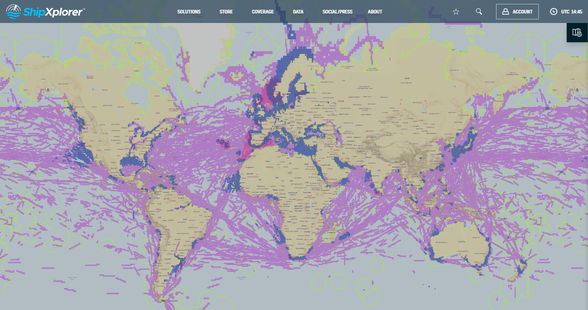
- shipxplorer
- ship-industry
- vessel-tracker
- ship-tracker
- ais
- hardware
- blog
2022-09-04 15:09 UTCSharing AIS data with ShipXplorer
Read our blog post and learn how to share AIS data and the benefits of being a ShipXplorer feeder.